


Fred-Thierry-Ben_16_05_2021

fredtruc27
User
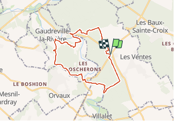


3h30
Difficulty : Easy

FREE GPS app for hiking
 SityTrail
IGN / Geographical institutes
SityTrail Plus
The world is yours!
About
Trail Walking of 14.4 km to be discovered at Normandy, Eure, Les Ventes. This trail is proposed by fredtruc27.
Description
belle rando de 3h30 avec de belles découvertes (Hara, maison, forêt, champs, animaux, rivière)
c'est l'occasion de voir des augers qui permettent de conduire l'eau de l'iton qui a tendance à disparaitre sois la terre au niveau du sec Iton.
Positioning
Comments